Discovering NASA's Visible Earth: A Treasure Trove of Satellite Images
If you’ve ever wondered what our planet looks like from space, NASA’s Visible Earth website is the perfect place to explore. The site is packed with thousands of amazing satellite images of Earth. And the best part? Approximately 99.9% of the content is in the public domain! This means anyone can access, download, and use these incredible images for free.
Let’s take a closer look at what makes NASA’s Visible Earth collection so special, how the images are taken, and how you can use them!

What Is NASA’s Visible Earth?
NASA’s Visible Earth is a U.S. government website that offers a huge collection of high-quality satellite images of Earth. These images are taken from space by satellites that orbit the planet, capturing everything from sweeping shots of entire continents to close-up views of cities, forests, and oceans.
What makes Visible Earth unique is that almost all the images are in the public domain. Whether you’re a student working on a science project, a teacher looking for cool pictures to share with your class, or someone who loves learning about Earth, Visible Earth has something for you.
How Does NASA Capture These Images?
NASA relies on a fleet of advanced satellites to capture breathtaking images of Earth from space. These satellites orbit the planet at various altitudes, with some hundreds of miles above the surface and others positioned even farther out. They are equipped with sophisticated cameras and sensors that capture images using different wavelengths of light, including visible and infrared light. This allows scientists to observe the Earth in multiple ways, revealing details that aren’t always visible to the naked eye.
One of the most iconic satellites in NASA’s collection is Landsat, a joint program between NASA and the U.S. Geological Survey. Since its launch in 1972, Landsat has continuously provided some of the most detailed images of Earth’s surface. Over the years, it has documented the transformation of landscapes, from the expansion of cities to the clearing of forests, offering an invaluable historical record. The program is now on its ninth satellite, continuing its mission of tracking changes to Earth’s ecosystems, coastlines, and natural resources.
Another key satellite is MODIS (Moderate Resolution Imaging Spectroradiometer), which is mounted on NASA’s Terra and Aqua satellites. MODIS takes pictures of the entire Earth every one to two days, capturing large-scale events such as wildfires, dust storms, hurricanes, and changes in vegetation. Its ability to monitor Earth frequently makes it essential for understanding how our planet is changing on a global scale.
Adding to these capabilities is the Suomi National Polar-orbiting Partnership (Suomi NPP) satellite, which enhances NASA’s ability to monitor the planet’s weather and climate. Launched in 2011, Suomi NPP captures high-resolution images using a variety of instruments, including the Visible Infrared Imaging Radiometer Suite (VIIRS). This instrument can measure everything from sea surface temperatures to the brightness of city lights at night, giving scientists detailed insights into both natural and human activities. VIIRS is especially important for tracking environmental phenomena like algal blooms in oceans or the extent of Arctic sea ice.
These satellites, along with others in NASA’s Earth-observing fleet, work together to provide a comprehensive and continuous view of our planet.
Why Are These Images Important?
The satellite images on NASA’s Visible Earth aren’t just pretty pictures. They are incredibly valuable for scientists, researchers, and governments around the world. Here are a few reasons why these images are so important:
Monitoring Environmental Changes: Satellite images help scientists track changes on Earth over time. This could include shrinking glaciers, deforestation, or the spread of wildfires. By comparing images taken over many years, scientists can see how human activity and climate change are affecting the planet.
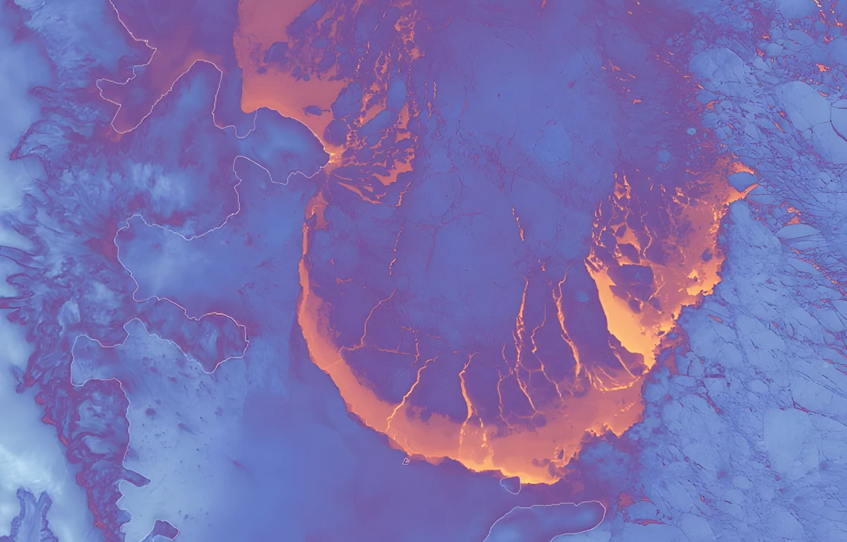
Tracking Natural Disasters: When a natural disaster like a hurricane, earthquake, or volcanic eruption occurs, satellites can capture images in real-time. This helps emergency responders and governments plan their response and assist people affected by the disaster.
Studying Urban Growth: Cities are growing larger every year, and satellite images allow scientists to track how urban areas expand. This helps with city planning, transportation, and even reducing pollution.
Climate Science: Satellites can monitor weather patterns and climate changes, giving scientists valuable data to understand global warming and other climate-related issues. By studying images over time, they can predict future trends and help countries prepare for changes like rising sea levels or more frequent storms.

Types of Images You Can Find on Visible Earth
The NASA Visible Earth website has images on nearly every subject you can imagine related to Earth. Here are some of the categories you’ll find:
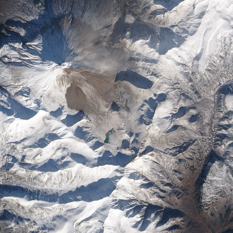
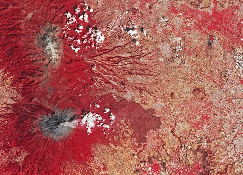
Land: These images focus on the planet’s landforms, including mountains, deserts, forests, and farmlands. You can find images that show how these areas change over time due to natural processes like erosion or human activities such as agriculture.
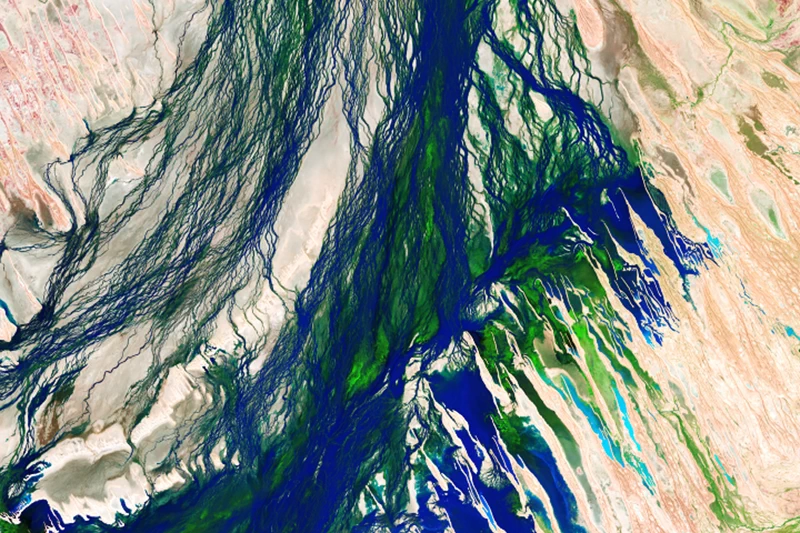
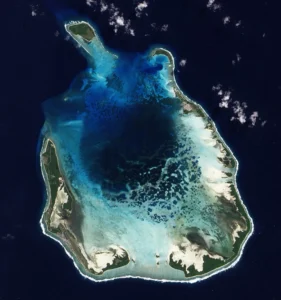
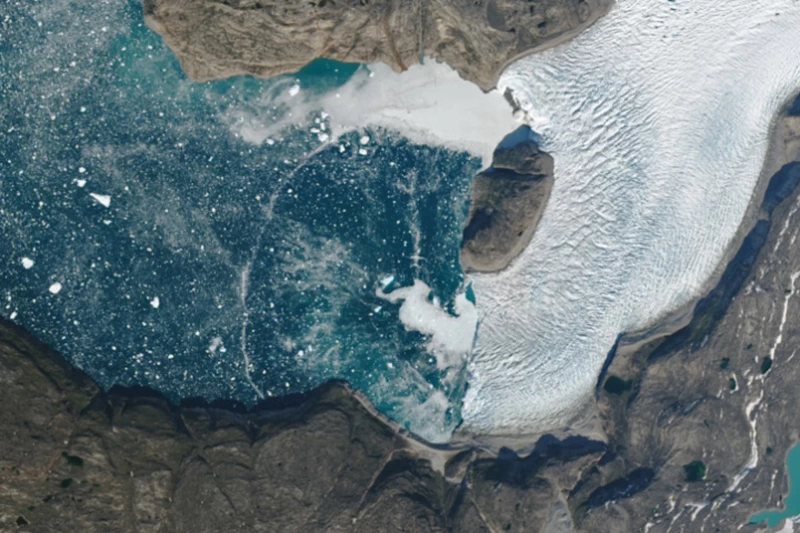
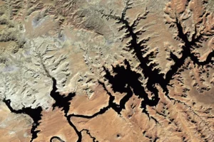
Water: Water covers more than 70% of our planet, and satellites capture stunning images of oceans, rivers, lakes, and glaciers. These images show how water levels rise and fall and how ice sheets in the Arctic and Antarctic are shrinking due to climate change.
Atmosphere: This category contains images of weather patterns, including hurricanes, tornadoes, and cloud formations. It also shows pollution and dust storms, helping scientists study the effects of these events on the environment and human health.
Life: Here, you can explore images that show where life exists on Earth, from the lush rainforests of the Amazon to the dry deserts of Africa. Some images even capture seasonal changes, like trees turning red and orange in the fall or blooming flowers in the spring.
Human Impact: These images focus on how humans are affecting the planet. From deforestation to sprawling cities, these images provide a visual representation of how our actions are changing the landscape of Earth.

Cool Ways to Use NASA’s Visible Earth Images
Since the images on NASA’s Visible Earth are free for anyone to use, there are countless ways to incorporate them into projects, research, or even your creative hobbies. Here are some cool ideas:
- Art and Design: Many artists and designers use NASA’s satellite images as inspiration. The swirling colors of clouds, the patterns of rivers cutting through deserts, and the changing colors of the seasons all make for beautiful pieces of art.
School Projects: Whether you’re studying geography, science, or the environment, these satellite images can bring your school projects to life. For example, if you’re doing a report on deforestation, you can use images that show changes in forests over time.
Presentations: Teachers and students alike can use these images in presentations to make learning more engaging. Instead of showing simple graphs or diagrams, why not include an actual satellite image of a hurricane or a wildfire to make your point more vivid?
Research: Scientists and researchers often use these images to track long-term changes on Earth. For instance, they might study images of melting ice caps to understand how quickly glaciers are shrinking.
How to Use NASA’s Visible Earth Website
Navigating NASA’s Visible Earth website is straightforward. Follow this simple guide to start exploring the collection:
Search for Images: You can browse by satellite source or curated collections like “Fall Colors” or “Earth at Night”, or simply use the search bar to look for something specific.
- Read Image Descriptions: Each image includes a detailed description that explains what the image shows, when it was taken, and which satellite captured it. While most images are in the public domain, a small number may have copyright restrictions, which will be clearly marked in the description.
- Download Images: Most images are available in high resolution, making them perfect for downloading and using in your projects, presentations, or research.
With these easy steps, you’ll be able to dive into NASA’s stunning collection of satellite images and use them however you like.

NASA’s Visible Earth is more than just a collection of satellite images. It’s a window into our planet, showing us how Earth looks from space and how it’s changing over time. The images are not only stunning to look at, but they also provide important information for scientists, researchers, and educators. And since they’re free for everyone to use, you can explore the world from the comfort of your own home.
NASA is constantly updating the collection with new images. This means there’s always something new to discover, whether it’s a recent hurricane swirling across the Atlantic or changes in a glacier thousands of miles away.